

Indian Ocean tsunami 20 years on: Improved warning systems but better forecasting still needed
CHRISTMAS holidays tend to be a time of much joy for many families around the world. However, this year’s festivities also hold much sadness, as the 20th anniversary of the devastating Indian Ocean tsunami is remembered on Thursday (Dec 26).
Two decades after the deadly waves in the Indian Ocean, our ability to forecast and warn of future dangerous tsunamis has grown. However, the economic and wider human cost of such natural catastrophes in the future can never be completely prevented.
This was illustrated by the concern, for instance, over the magnitude 7.0 earthquake which struck on Dec 5 about 88.5 km off northern California, impacting the area from San Francisco to southern Oregon. This sparked a tsunami warning for millions of residents.
Tsunami warnings are relatively rare for the US West Coast, but more common than they are for the rest of the country. However, some scientists assert that the region is potentially overdue for a massive quake and resulting tsunami in the Cascadia Subduction Zone and/or the San Andreas fault.
Some scientists refer to this potentially big natural event as “The Big One”, defined as a magnitude 8.0 earthquake or larger. This might cause hundreds of billions in damage, and at least tens of thousands of injuries and deaths.
Nonetheless, even a disaster of this magnitude may be dwarfed by the devastation caused by the Boxing Day 2004 tsunami in the Indian Ocean. According to the EM-DAT global disaster database, a total of 226,408 people died in more than a dozen nations, with more than 1.5 million people displaced.
The 9.1 magnitude earthquake, whose epicentre was off the western coast of Indonesia’s Sumatra island with the longest fault line rupture ever, was one of the largest in the world since 1900. The ocean floor opened at least 1,200 km in length between the India plate and Burma microplate.
This helped trigger the largest tsunami in the Indian Ocean for more than 700 years, releasing energy estimated to be equivalent to around 23,000 Hiroshima atomic bombs. Huge waves, some more than 30 m high, swept into multiple nations, including Indonesia, Sri Lanka, India, Thailand and other countries around the Indian Ocean.
Twenty years on, the silver lining amid the sadness of the anniversary is that our understanding of tsunami risks is enhanced. This includes forecasting, warnings and better disaster-resistant construction for infrastructure.
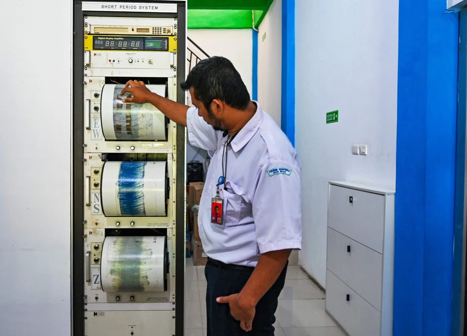
Focusing on warnings first, there were none in place in the Indian Ocean in 2004. However, that picture has changed with a regional system now as part of an around-1,400-station-strong network around the world, which generally cuts warning times to minutes after a tsunami forms.
Nonetheless, even with such better warning systems, some communities still may not receive the relevant information in time.
Indeed, even if the current Indian Ocean warning system had been in place in 2004, it is not certain it would have helped many of those who were earliest to be hit by the tsunami, especially the communities without modern digital technologies.
In part, this is why a significant portion of tsunami casualties tended to occur before any official or technically based warnings are delivered. This phenomenon is unlike some other natural hazards, such as hurricanes, that tend to have less casualties.
However, for more distant communities, tsunami warnings can be very effective, including via community communications. These can save many lives, with a key success factor being distributing data fast, transparently and hyperlocally, so that it is available in the best form, at the right place and as soon as possible.
As warning systems improve, there are continuing debates about enhanced data exchanges. This places an increasing weight upon improved forecasts. Here, many early indicators have been identified, but are often still not reliable enough to be widely used.
First, on earthquakes, one of the key causes of tsunamis, the science of prediction is improving. Pioneering work such as that of Delft University of Technology’s Professor Kees Vuik means that scientists might in the future be able to provide meaningful warnings.
Predicting earthquakes was once thought to be impossible, owing to the difficulty of calculating the motion of rocky mantle flows. However, owing to algorithms like those developed in Delft, it may now be possible to model these underground streams by creating a model (consisting of millions of underground grid points) of fault lines to ascertain where the underground stresses are strongest. This is a potential indicator of the key potential quake trigger points.
Beyond this promising work, one of the most exciting research for enhancing predictive capability is so-called holistic geophysical forecasting.
This makes use of the fact that the sizes of tsunami-related disturbances, including earthquakes, are so large and so powerful that they disturb the solid earth, the oceans and the atmosphere. These disturbances do not just lead to mechanical forces and release of heat, as in storms, but they also affect electrical, magnetic and molecular processes.
Modern instruments can measure magnetic pulls one millionth of the strength of the earth’s magnetic field. This means that tremors in the lithosphere can potentially be detected long before large earthquakes and tsunamis actually occur. Motions in tsunami waves, once initiated, can also be seen over long distances from measurements of weak, slowly changing magnetic fields.
However, even if warnings and forecasting fulfil their full future potential in the longer term, there is still a need for increasingly resilient infrastructure, given the potential devastation to physical geography from tsunamis.
Take the example of Aceh, a province of Indonesia, in 2004, where some hundreds of thousands of homes were destroyed, and around 3,000 hectares of land were washed away, sweeping away infrastructure like roads, ports and bridges. Subsequently, more than 100,000 houses were rebuilt in Aceh, according to the Indonesian government.
In this context, a key goal for engineers and community planners is to build increasingly tsunami proof-structures and plan more resilient communities. With the intensification of global warming, these calculations must also factor in the increasing risk from rising sea levels.
As Emeritus Professor Julian Hunt of University College London has shown, such rises are happening around three times faster in tropical seas (including the central portions of the Pacific and Atlantic oceans and most of the Indian Ocean) where tsunami risk is greatest.
Taken together, this underlines the further potential for better forecasting and warning of future tsunamis. However, economic and wider human cost will never be eliminated, even with increasingly resilient infrastructure.
The writer is an associate at LSE IDEAS at the London School of Economics
TRENDING NOW

Government to bring forward raising of retirement age, give employers more financial support to create flexi-load jobs

If Europe goes to war, the fallout will be felt in East Asia
Former minister Maliki Osman, Revolut chairman join Asia Gulf Holdings advisory board

Small nuclear reactors could boost the Asean Power Grid: GE Vernova executive

