

Rare ‘super’ El Nino this year shaping up to be the worst on record
US forecasters see an 83% chance that the El Nino this year will be the most severe in records dating back to 1950
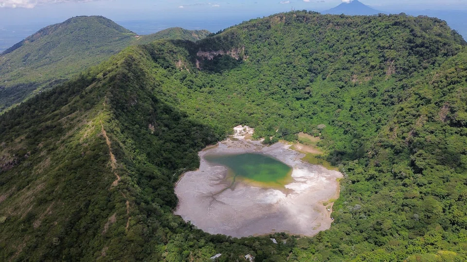
EL NINO is back and shaping up to be the most powerful on record.
The US Climate Prediction Centre declared in June that the cyclical climate phenomenon had returned. It begins when the atmosphere reacts to warming across the equatorial Pacific Ocean.
As it unfolds, it reshapes weather patterns across the globe. Heat and drought can intensify in some regions, while rainfall and flooding increase in others. The resulting disruption to crop and energy markets risks pushing up inflation and slowing economic growth.
This El Nino has already coincided with the weakest Indian monsoon in more than a decade, exacerbated wildfires in Indonesia and threatened sugar and coffee output in Brazil.
A patch of the Pacific monitored by the Japan Meteorological Agency was 4 deg C hotter than normal in September — the highest anomaly in almost eight decades.
US forecasters see an 83 per cent chance that by the end of the year, this El Nino will be the most severe in records dating back to 1950. That prediction has bolstered the view of many that this will turn out to be a “Super El Nino.”
What is El Nino?
El Nino was first observed in the 1600s by Peruvian fishermen, who noticed that Pacific waters were unusually warm around Christmas time in some years. They named this naturally occurring phenomenon “El Nino de Navidad” in reference to the Christ Child.
During El Nino, trade winds that normally blow east-to-west and push warm Pacific water toward Asia begin to weaken or even reverse direction. It’s unclear what triggers this shift, but it results in warm water drifting toward the Americas, heating large parts of the central and eastern Pacific Ocean. The extra warmth changes the atmosphere above the sea. Storm tracks shift and rainfall patterns move.

How often does El Nino occur?
There’s no fixed timetable for when El Nino emerges. It typically appears every two to seven years and varies in strength and duration. The last event was in 2023-2024.
El Nino is part of a larger Pacific climate cycle known as the El Nino-Southern Oscillation, or Enso. The cycle swings between El Nino, its cooler counterpart La Nina and a neutral phase in between. During La Nina, the east-to-west trade winds become stronger, pushing warm water further west and resulting in a cooler-than-usual eastern Pacific.
The immense size of the Pacific Ocean, which covers around a third of the planet’s surface, gives Enso an outsized influence on global weather. While similar climate patterns exist in the Atlantic and Indian oceans, they don’t have the same reach.
El Nino and La Nina events usually peak between December and January, although their effects can linger for months.
What is a ‘Super El Nino’?
El Nino is identified by monitoring the temperature levels in the Pacific Ocean, most commonly in a region known as Nino 3.4.
The threshold for El Nino used by the US National Oceanic and Atmospheric Administration (NOAA), is when the sea surface temperature exceeds the long-term average by at least 0.5 deg C for five consecutive overlapping three-month periods.
For a strong El Nino, the temperature difference must be at least 1.5 deg C; for a very strong El Nino it must reach at least 2 deg C. In September, the Nino 3.4 region was 2.1 deg C hotter than normal.
“Super El Nino” isn’t an official term used by forecasters such as NOAA and the World Meteorological Organization. It’s been popularised this year as a very strong El Nino looks to be on the cards.
Very strong El Ninos are rare. There have only been around a handful since 1950 and the last one was in 2015-2016. Severe weather events are more likely to occur when there’s a stronger El Nino, but they’re not guaranteed.
How is the weather affected by El Nino?
The heat that El Nino slowly releases from the Pacific Ocean into the atmosphere often pushes global temperatures to new highs. Scientists expect 2027 to be one of the hottest years on record, potentially dethroning 2024, which came in 1.5 deg C above the pre-industrial average, according to NOAA.
El Nino doesn’t hit every region in the same way. The effects typically materialise in the tropics first, before spreading across Australia, Asia, the Americas and Africa.
Australia, South-east Asia, the northern US and Canada usually become warmer and drier, making them more prone to drought and wildfires. India can experience disruptions to monsoon rainfall. The southern US, Chile, Argentina and parts of East Africa frequently experience wetter conditions and a greater risk of flooding.
The Atlantic hurricane season often becomes quieter during El Nino years because increased wind shear — a sudden change in wind speed or direction — tears apart developing storms.
The hurricanes that do form could still be highly destructive, but a lower frequency could reduce the harm to communities and infrastructure and limit disruption to oil and gas assets in the Gulf of Mexico.
There are usually around 14 named Atlantic storms from June through November — storms are given names when their wind speeds reach 63 kmh. NOAA expects there to be only seven to 13 this time around, in part due to El Nino. As of early October, just one storm had reached hurricane status.
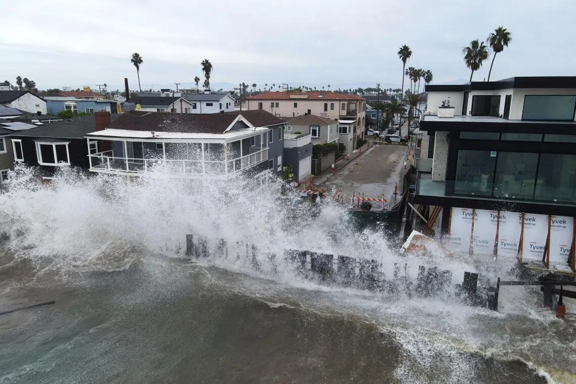
By contrast, typhoon activity across the Pacific tends to increase during El Nino years. The warmer water provides more fuel for these tropical storms. That translates to a higher risk of typhoon damage in Asia and Hawaii — both of which have been slammed with deadly storms this season at a steep economic toll — as well as Mexico.
Why do the changes from El Nino matter?
El Nino is one of the world’s most closely watched climate signals because it offers clues about storms, drought risk, crop yields and energy demand months in advance.
Utilities use Enso forecasts to gauge demand for heating and cooling. Higher temperatures boost electricity consumption for air conditioning. This can strain power grids and trigger blackouts. Less rainfall reduces output from hydroelectric dams.
Commodity traders watch for threats to crops, mining operations, oil and gas production and shipping routes. Drought can lower water levels in the Panama Canal, which connects the Atlantic and Pacific oceans, slowing cargo traffic through one of the world’s busiest shipping bottlenecks.
El Nino can have both positive and negative effects but the global economic losses have historically outweighed the regional benefits. Scientists at Dartmouth College looked at the lingering five-year fallout from El Ninos and estimated that the 1997-1998 event led to US$5.7 trillion in lost gross domestic product globally.
How does El Nino affect food production?
Some crops benefit from El Nino. Higher rainfall in California, for example, is good for avocado and almond yields. However, many staples, including rice, wheat, palm oil, coffee and sugar, are produced in areas likely to face drier and hotter conditions.
Beyond the impact on land, El Nino can disrupt ocean fisheries. The warm Pacific water flowing eastward keeps a lid on cooler, nutrient-rich water ascending to the sea surface, resulting in fewer phytoplankton for fish to eat. Some fish, such as anchovies off the coast of Peru, may seek cooler, deeper water, making them harder to catch, while tropical species may venture to areas that are normally too cold.
Lower crop harvests, smaller fishing hauls and livestock casualties from extreme weather can threaten global food security and push up prices.
Is climate change affecting El Nino?
Scientists are still debating how climate change may influence the frequency and intensity of El Nino. Earlier models predicted that the natural phenomenon might become more common as the planet warmed. Yet much of the 21st century has instead been dominated by La Nina conditions, underscoring how much scientists still don’t understand about the Enso cycle.
There are also concerns about overestimating El Ninos and underestimating La Ninas as the oceans get hotter, given that they’re typically determined by measuring anomalous warmth compared with preceding decades.
There is growing agreement that a hotter world can intensify many of El Nino’s impacts. Higher temperatures can worsen drought in already dry regions, while warmer air holds more moisture, which can make downpours heavier during storms. BLOOMBERG
Decoding Asia newsletter: your guide to navigating Asia in a new global order. Sign up here to get Decoding Asia newsletter. Delivered to your inbox. Free.
Share with us your feedback on BT's products and services
TRENDING NOW

Once staunchly pro-China, Malaysian Chinese businesses are now distancing themselves from Beijing

AI can become superior to humans in certain aspects: TikTok’s Chew Shou Zi

DBS, OCBC, UOB face rate hike reality check

‘The market has spoken’: DBS CEO Tan Su Shan says market is repricing AI financing risks

